

More than a century before Katy, Texas became one of the Houston area’s fastest-growing communities, the Great Galveston Hurricane of 1900 nearly wiped the young town off the map. According to the Texas Historical Commission, the deadly hurricane “razed or damaged all improvements except two houses in Katy.” Today, one remarkable scar from the storm still survives: a historic Katy home that was blown from its foundation and has stood crooked to the street ever since.
At the corner of East Fifth Street and East Avenue, the Morrison-Freeman House is turned slightly on its lot. Its front wall runs diagonally to East Fifth, leaving one corner of the house closer to the road than the other. “What happened here?” a traveler might ask of the strangely plotted house. Said traveler would find the answer on the historical marker outside.
Built in 1898 for William Patrick Morrison, an early Katy grocer and the town’s second postmaster, the Morrison-Freeman House was only two years old when the Great Galveston Hurricane of 1900 tore across the prairie. According to the Harris County Historical Commission, the wind blew the house from its foundation blocks. The structure survived, but it has been crooked ever since.
That slight angle is one of the few physical scars remaining from the night America’s deadliest weather disaster reached Katy.

The Great Galveston Hurricane earned its place in history for the brutal destruction of Galveston Island, where thousands of people died beneath collapsing buildings, storm debris and a 15-foot surge. The storm continued inland, wrecking settlements across Southeast Texas.
However, few remember the devastation the Great Galveston Hurricane caused to the then-new community of Katy.
Katy was still a new railroad town when it arrived. The Texas Historical Commission’s marker for the city describes the nearly fatal blow in one sentence, “The 1900 hurricane razed or damaged all improvements except two houses in Katy.”
Almost everything the young community had built was either damaged or destroyed.
A Four-Year-Old Town on the Prairie
The Katy of 1900 bore little resemblance to the city surrounding Interstate 10 and the Grand Parkway today.
The area was first known as Cane Island, a stagecoach stop along the old San Felipe Road. The Missouri, Kansas and Texas Railroad helped turn the scattered settlement into a town. Developers platted Katy in 1895, and the post office opened inside a mercantile store on Jan. 23, 1896.
Rice farming had already begun changing the land. William Eule raised a crop in 1897, and his son Fred dug an irrigation well in 1899. The railroad depot was completed in 1898.
That same year, Katy built its first public schoolhouse. The one-room wooden building served the children of farmers, ranchers and railroad workers. Baptist and Methodist congregations were also organized in 1898, although the Texas State Historical Association’s history of Katy says they initially met in homes or inside the school.
The town had a depot, a post office, stores, houses, a school and the beginnings of organized church life. Its first reported population after the storm would be only 119 people in 1904.
Katy had existed under its new name for only four years when the hurricane arrived.
The Storm Reached Texas With Little Warning
The hurricane crossed the Caribbean and Cuba before entering the Gulf of Mexico. Forecasters at Cuba’s Belén Observatory believed it would continue northwest into the Gulf, while the U.S. Weather Bureau expected it to turn toward the northeast. As a NOAA history of the storm explains, only the Weather Bureau forecast was carried over the telegraph.
Ships encountered hurricane-force winds in the Gulf, but they lacked wireless equipment capable of reporting those conditions to shore.
Galveston received an order to raise its storm-warning flag on Friday, Sept. 7. Many residents were unconcerned, expecting nothing worse than storms they had experienced before.
The following morning brought high tides and intermittent rain. Gulf water began flooding streets during the afternoon. According to the Galveston & Texas History Center, the wind became severe by 4:30 p.m. The Weather Bureau’s instrument recorded approximately 100 mph before it was blown away.
Modern estimates place the hurricane’s sustained winds as high as 145 mph. The storm surge reached approximately 15 feet, high enough to inundate an island whose highest point stood less than 9 feet above sea level.
Houses near the Gulf were ripped apart first. Their lumber, along with household belongings, became dangerous, fast-moving debris that battered buildings farther inland. Railroad bridges connecting Galveston to the mainland washed away, while telegraph lines went down and left the city isolated.
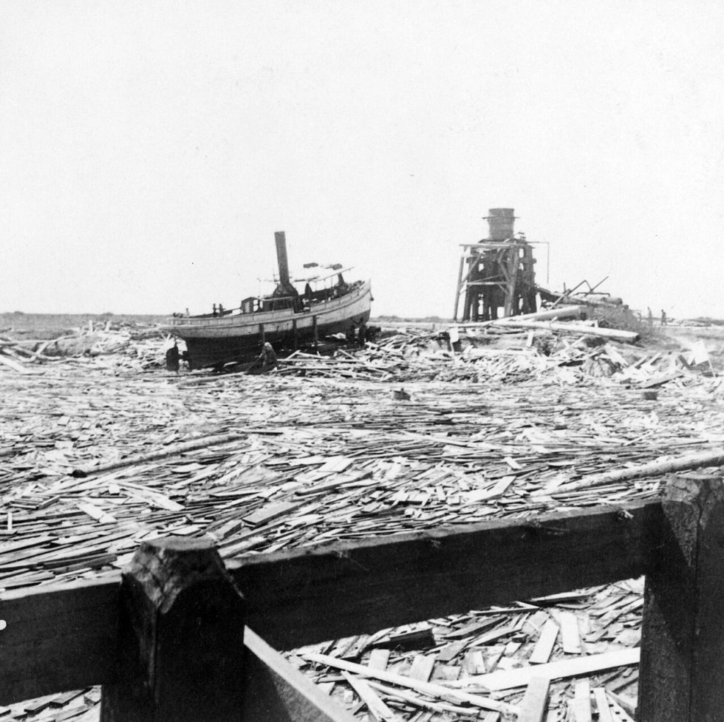
Photo: Floating wreckage near Texas City – typical scene for miles along the waterfront
The precise number of dead will never be known. The Galveston & Texas History Center considers 7,000 to 8,000 deaths likely, while NOAA estimates range as high as 12,000. Some entire families vanished, leaving nobody to report its members missing.

Photo: Galveston Disaster, Texas, body in the ruins on wharf
Near midnight, as the water began receding in Galveston, the hurricane was moving through the mainland. A NOAA reconstruction of the storm includes a report of 60 mph winds in Houston at midnight, with heavy damage already occurring to homes and businesses.
The storm then continued across the prairie settlements west and northwest of Houston.
The Storm Struck Katy by Night
Surviving records provide far more information about Katy’s damaged buildings than about the people who endured the storm. Fortunately, nobody in Katy perished, but the destruction of the town itself is well documented.
Katy’s first schoolhouse, built only two years earlier, was destroyed. The one-room building had served as both the town’s classroom and a meeting place for its young congregations. The community rebuilt it on the same site, but classes needed somewhere to meet in the meantime.
The Featherston House provided that space.

Photo: Historical marker photographed by James Hulse, January 18, 2021
Constructed in 1898 for W.H. Featherston and his wife, Amelia, the two-story house had served as both the family’s residence and a boardinghouse, with the Featherstons living downstairs and renting rooms on the upper floor. Featherston was also one of the 12 charter members who organized Zion Baptist Church, now First Baptist Church of Katy, in November 1898.
The house was among the few Katy homes left undamaged by the hurricane. Its historical record states that residents temporarily used it as both a school and an infirmary after the storm.
Children attended lessons inside a house where people injured or sick in the hurricane’s aftermath were also being cared for. Two of the battered town’s most immediate needs, education and medical care, were placed under one roof.
Featherston entered the ministry in 1906 and became one of the Baptist congregation’s early pastors. The Katy Heritage Society remembers him as the town’s first paid preacher. His house remained part of Katy life for decades and was later connected to the neighboring Cobb Hotel.

The Wright House also escaped the hurricane without damage. Edward Everhart built it in 1898 and sold it to David Wright on July 24, 1899, less than 14 months before the storm. The Wright House marker identifies it as one of only two Katy homes that escaped damage.
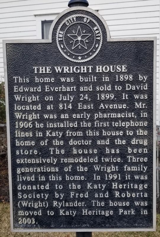
Photo: Historical marker photographed by James Hulse, January 18, 2021
David Wright became an early Katy pharmacist. In 1906, he installed the town’s first telephone lines, connecting his house with the Stewart and Wright Drug Store and the home of Dr. J.M. Stewart.
Local histories identify the Wright and Featherston houses as the two undamaged homes mentioned on Katy’s city marker.
The aforementioned Morrison-Freeman House survived under different circumstances. The building remained standing, but the hurricane pushed it off its blocks and left it out of alignment with the street. Its survival indicates why the historical record distinguishes between buildings that remained and houses that escaped damage.
In this case, the house survived the devastating storm, but it was peculiarly relocated.
Sadly, the historical marker does not itemize what happened to every store, outbuilding or piece of railroad property in Katy. It contains broad wording that leaves little doubt about the scale: all of the town’s improvements, aside from two houses, were either razed or damaged.
The Damage Spanned Across West Houston
Katy was one piece of a much larger inland disaster.
At Addicks and Bear Creek, German immigrant families had established farms, a school, a post office, a church, a general store and a social club. The railroad had recently shifted the commercial center toward what is now the intersection of Interstate 10 and Highway 6.
The Texas State Historical Association records that both Bear Creek and Addicks were destroyed in the 1900 hurricane. Residents rebuilt, and the Bear Creek German Methodist Church was moved away from persistent flooding along Langham Creek.
Farther east, the railroad settlement of Barker had an inn, a depot, a brick factory, a twine mill, two churches, a school, a store and a saloon. The inn built by George Miller north of the tracks was destroyed.
Alief had already suffered a severe flood in 1899. The hurricane arrived the following year and destroyed its Methodist Episcopal church along with corn and cotton crops awaiting harvest.
The International–Great Northern Railroad offered residents free transportation out of town. Many accepted. According to TSHA’s history of Alief, only six of the community’s 30 families remained, along with the Bassinger General Mercantile Store. The town reverted so completely to prairie that wolves were reportedly seen during the day.
Alief eventually recovered, and many former residents returned by 1904. In the immediate aftermath, however, four out of every five families had left.
Reports reaching Gov. Joseph Sayers in the first days after the storm described a similar trail of destruction farther west and south. A contemporary compilation of official reports and newspaper dispatches called Brookshire “wrecked” and said hundreds there were destitute. Richmond was described as so badly demolished that clearing the town would take weeks. Missouri City and Stafford were reported virtually demolished.
Communication lines remained badly damaged, and early casualty estimates changed as additional information arrived. The reports still capture the geographic reach of the disaster: Galveston’s catastrophe continued through Harris, Waller and Fort Bend counties, damaging homes, businesses, farms, railroads and crops.
Several of these communities later disappeared, relocated or became absorbed into metropolitan Houston. Their longer stories appear in Katy Christian Magazine’s guide to ghost towns and lost communities around Katy.
How Did Katy Stay on the Map?
The Texas Historical Commission’s account says Katy was “soon rebuilt,” and the surviving record shows what that meant.
The wooden schoolhouse went back up. In 1904, the Methodist congregation constructed a church building that all of Katy’s congregations could use. By 1905, the town supported two hotels, two livery stables, two lumberyards and a saloon.
Rice became the principal local crop. Irrigation wells turned the prairie into fields, while the Missouri, Kansas and Texas Railroad carried agricultural products and connected Katy with Houston and other markets. Brookshire experienced a similar agricultural recovery as rice production expanded after 1900.
Katy replaced its modest school facilities as the town grew. A two-story red brick schoolhouse with a bell was completed in 1909, and Katy Independent School District was established in 1918. The depot was enlarged in 1919.
Gradually, residents rebuilt the rest of the infrastructure they most heavily depended upon: houses, classrooms, businesses, churches and agricultural operations.
Katy eventually outgrew the railroad settlement that the storm had nearly erased. Petroleum development strengthened the economy beginning in the late 1920s, the Katy gas field followed in the 1930s and the city formally incorporated in 1945.
The town’s population reached 849 in 1950. Today, the Katy name covers a much larger suburban region across Harris, Fort Bend and Waller counties.
Where Can Evidence of Katy’s 1900 Hurricane History Still Be Seen?
The Morrison-Freeman House remains at 5502 East Fifth Street, still crooked to the street because of what happened in 1900. It is a historic private home, but its marker can be seen from the roadside.
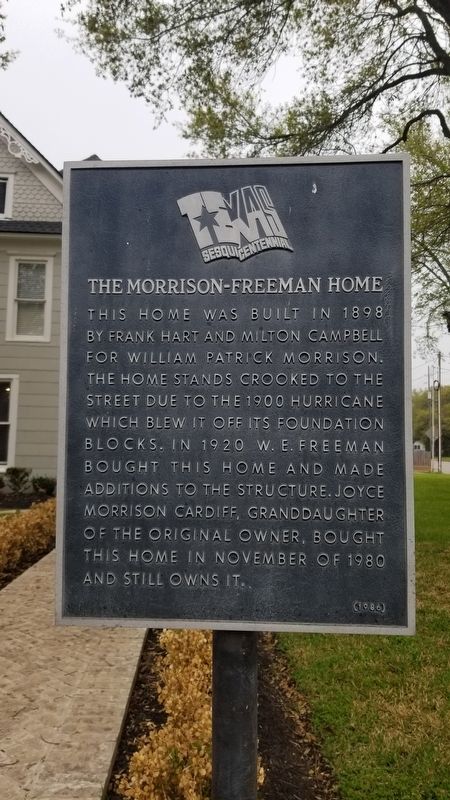
Photo: Historical marker photographed by James Hulse, March 24, 2021
The Wright and Featherston houses now stand at Katy Heritage Park, 5990 George Bush Drive. Both were moved to the park in 2003 and preserved as part of the city’s collection of historic homes. The City of Katy’s museum guide lists monthly tours of the interiors.
The 1898 Missouri, Kansas and Texas Railroad depot also survives at 5615 First Street. Now part of the MKT Railroad Depot Museum and Katy Railroad Park, it preserves the transportation history that helped Katy rebuild and remain a viable town.
Katy has no seawall or towering monument dedicated to the Great Storm. Its history survives in smaller evidence: a house standing at an angle, another house that became a classroom and infirmary, and a school marker recording how quickly the community resumed teaching its children.
The Great Storm of 1900 belongs to Galveston’s history, but the crooked house on East Fifth Street shows that it belongs to Katy’s history, too.
Enjoyed this article? Continue exploring the overlooked people, places and events that shaped Katy, Greater Houston and Texas in Katy Christian Magazine’s history archive. Read more from our Forgotten Histories series:
- Before There Was Katy: 10 Ghost Towns and Lost Communities You Never Knew Existed
- The Battle of Medina: The Bloodiest Battle in Texas History, Yet Most Texans Have Never Heard of It
- The 10 Greatest Lost Treasures in Texas: Spanish Gold, Pirate Treasure, Buried Silver and Hidden Fortunes
- Is Patterson Road Really Haunted? The Truth Behind Houston’s Most Haunted Road
- The New London School Explosion: The Deadliest School Disaster in American History Happened in Texas
- The Great Hangings at Gainesville: Texas’ Darkest Chapter and the Largest Mass Hanging in American History
- Before Jack the Ripper: The Servant Girl Annihilator Who Terrorized Austin, Texas
- The Nueces Massacre of 1862: The Forgotten Texas Civil War Tragedy Where Wounded Unionists Were Executed